Telemetry Map
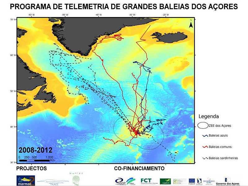
We are working on a revised and updated version of our highly requested Whale Telemetry Map poster. Meanwhile you can download the old version with data from 2008-2012.Telemetry track data were obtained under research permits by Portuguese authorities and collected under a strict ethical protocol. The poster can be used for non-commercial purposes but cannot be altered in any way. Namely, the mention to image credits, project and funding institutions must be maintained intact. Use for any commercial purpose is strictly forbidden, however the images can be used as a visual aid by wildlife tour operators.
Make sure you return to this page soon and get the new map, with many more whales!
Follow this link to download the telemetry map as a pdf file (943 KB)